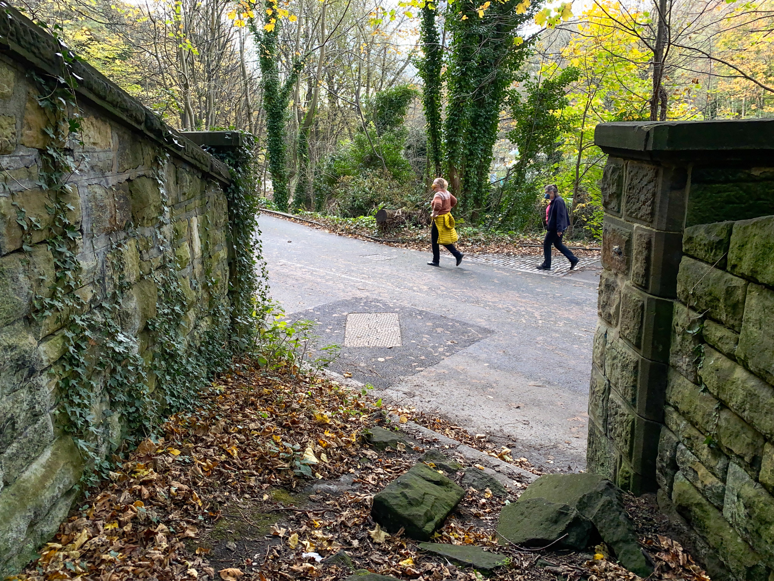
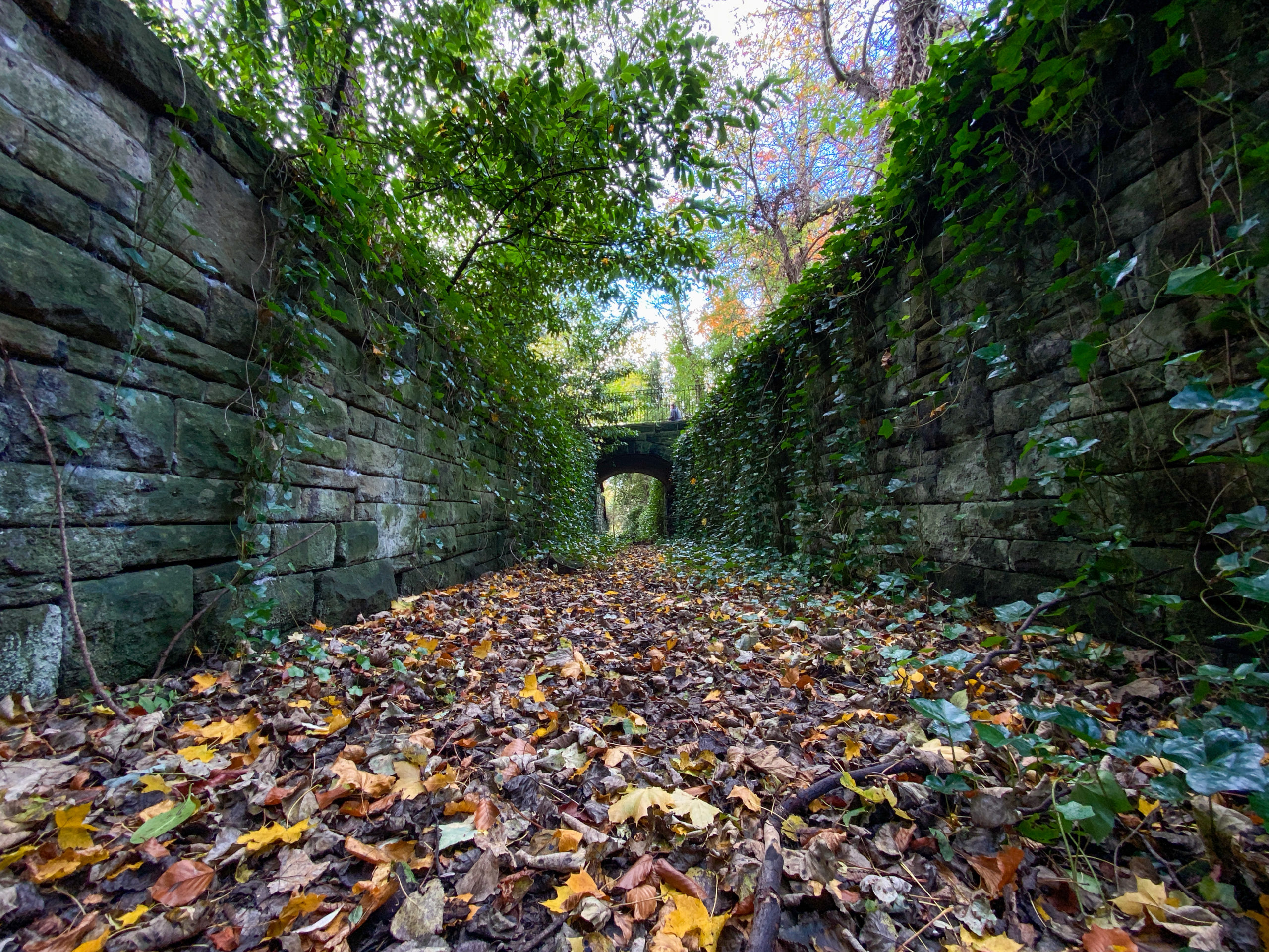
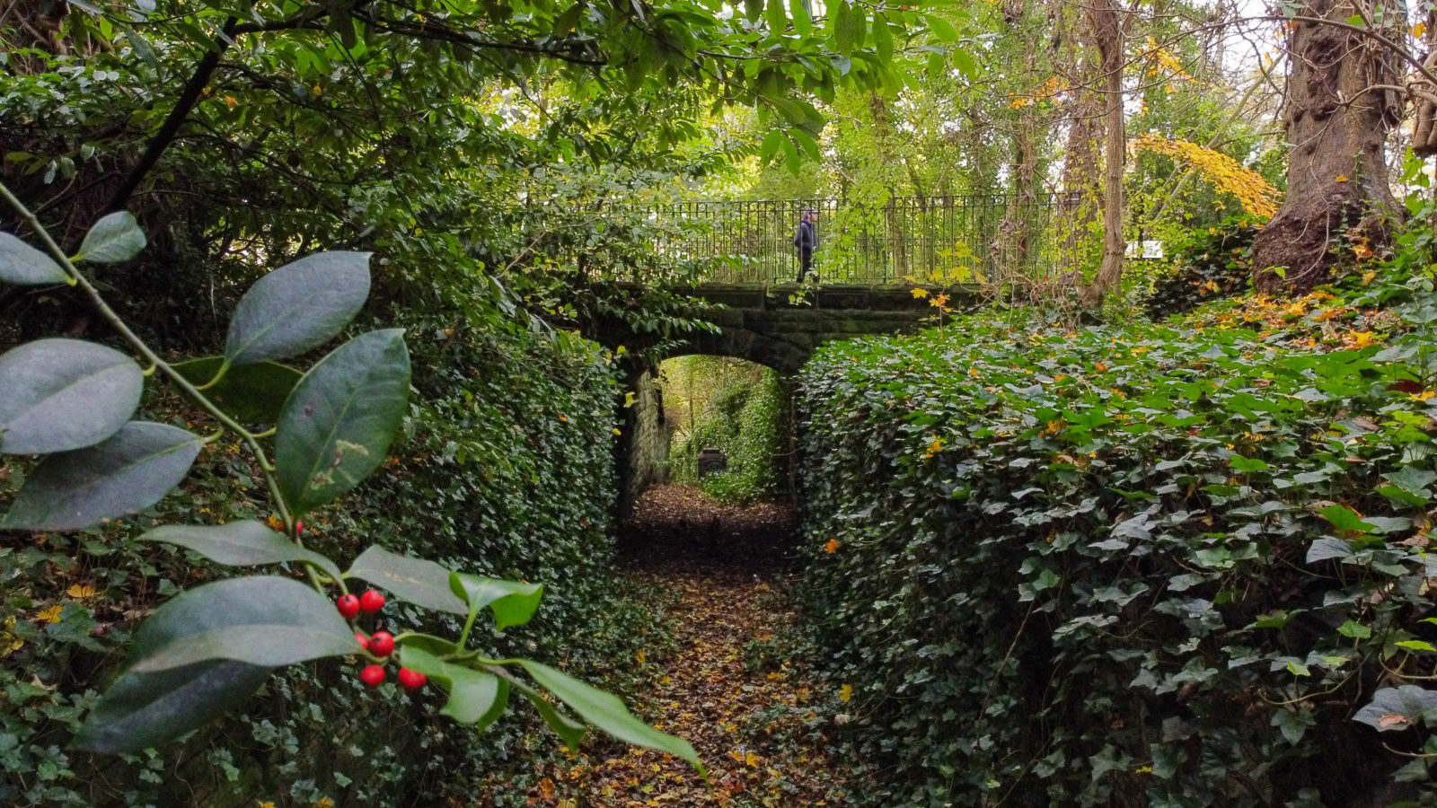
“When [Lord] Armstrong was given the land,” the panel explains, “he had this deeper channel dug so that cattle could follow the old track and be kept apart from visitors and their carriages.”
Using archive materials, period maps, and copious illustrations, let me and two experts show you why the lottery-funded interpretation panel is, in all likelihood, wrong.
FAKE MOOS
“For centuries, cattle had been driven down to pasture by the River Ouseburn from the fields above the valley,” states the interpretation panel. The dirt-covered panel is situated to the side of the upper of two bridges which span the 200-metre-long sunken feature in Armstrong Park. In the 19th Century this lozenge of land, which now sports the Shoe Tree, was known as Bulman’s Wood.
(Even though I argue here that the feature wasn’t designed for cows, I refer to it throughout this piece as the “cattle run.” Another descriptive convenience is the interchangeable use of Armstrong Park and Bulman’s Wood for roughly the same 29-acre plot of land.)
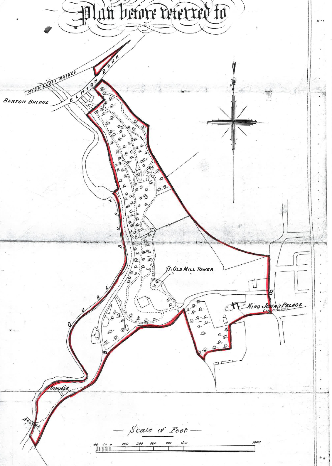
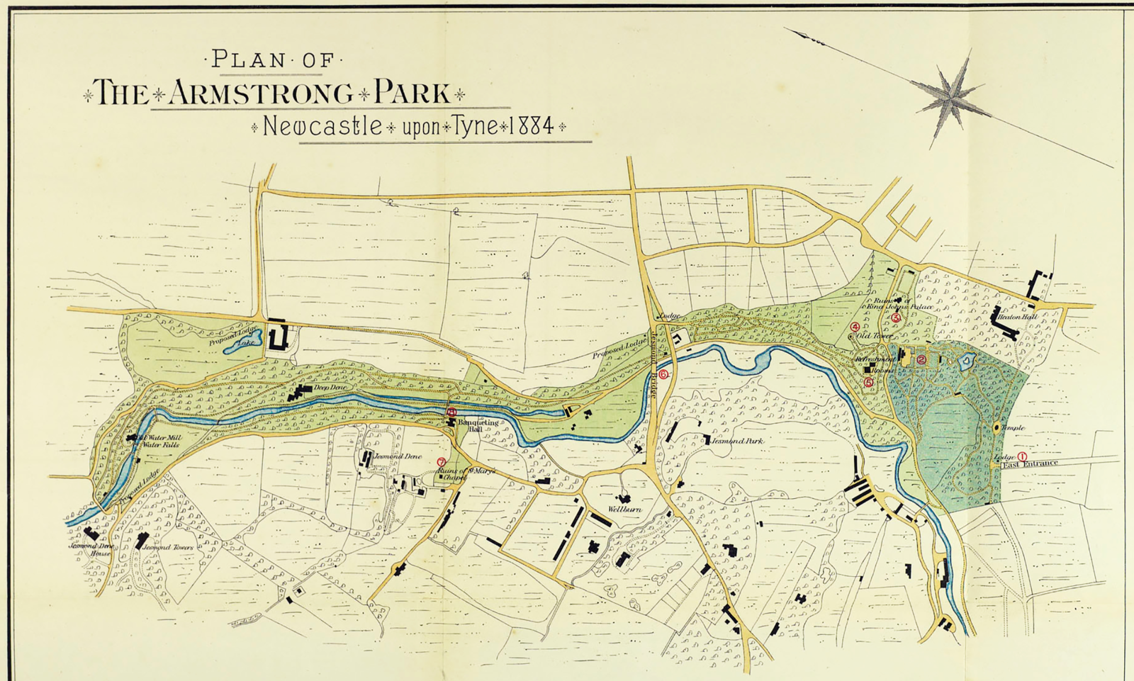
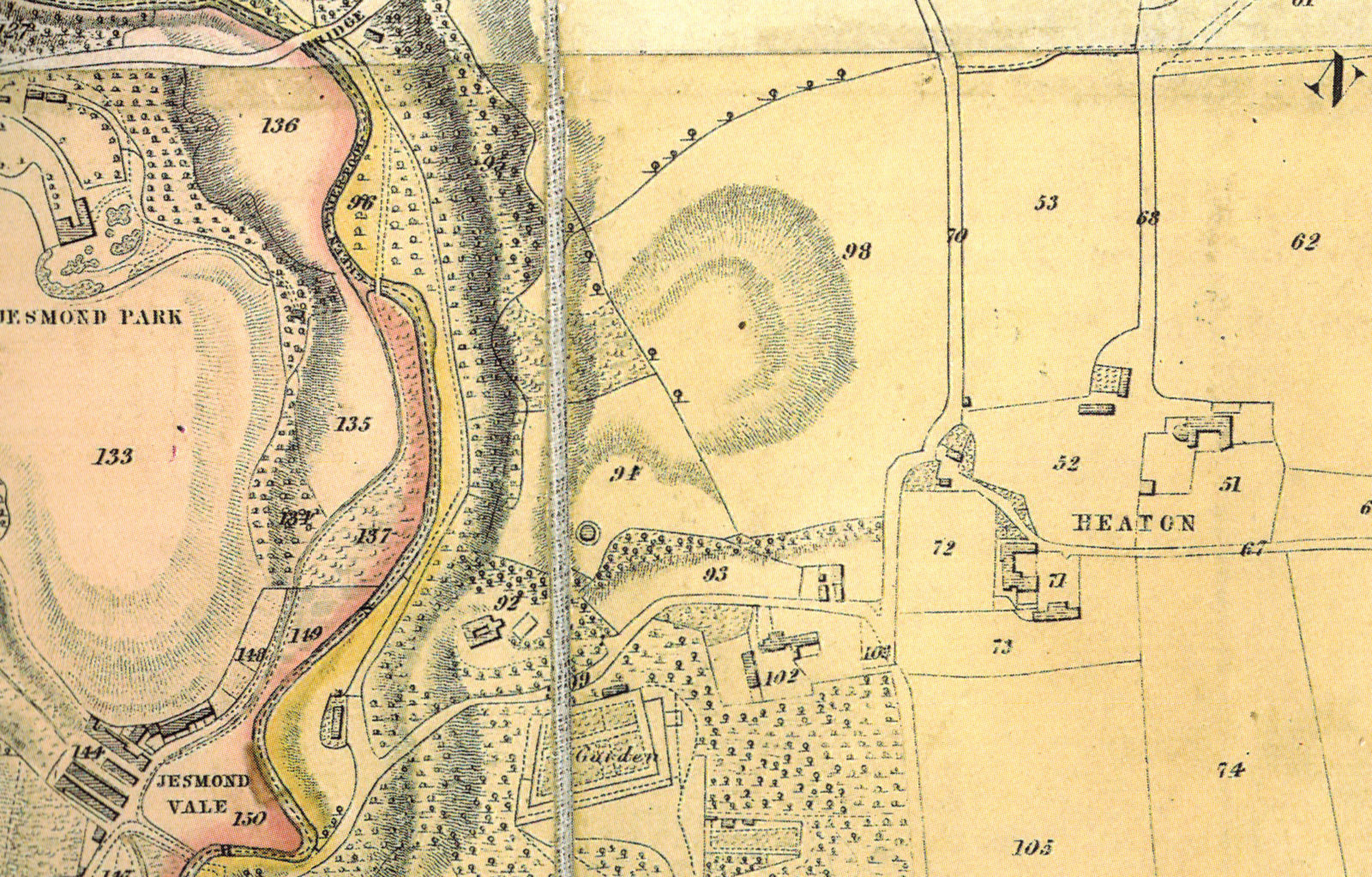
There’s a linear east-west feature marked on the large-scale map attached to the Deed of Gift of September 1879 in which Armstrong gave this woodland in perpetuity to the people of Newcastle, but it’s not labelled as a cattle run. The feature was constructed not in the 1850s, which the interpretation panel seems to suggest, but in 1880 when the council — then known as Newcastle Corporation — owned the land.
Armstrong may have handed Bulman’s Wood to the people of Newcastle via the council’s stewardship but, ever the canny speculator, he inserted a clause in the Deed allowing him to continue draining the parts of Heaton which he wished to later develop for housing.
I also speculate that, with the Victorian equivalent of a nod-and-a-wink, the Corporation incorporated Armstrong’s pre-designed linear feature into their plans for what they named Armstrong Park.
REMARKS ON A CUTTING
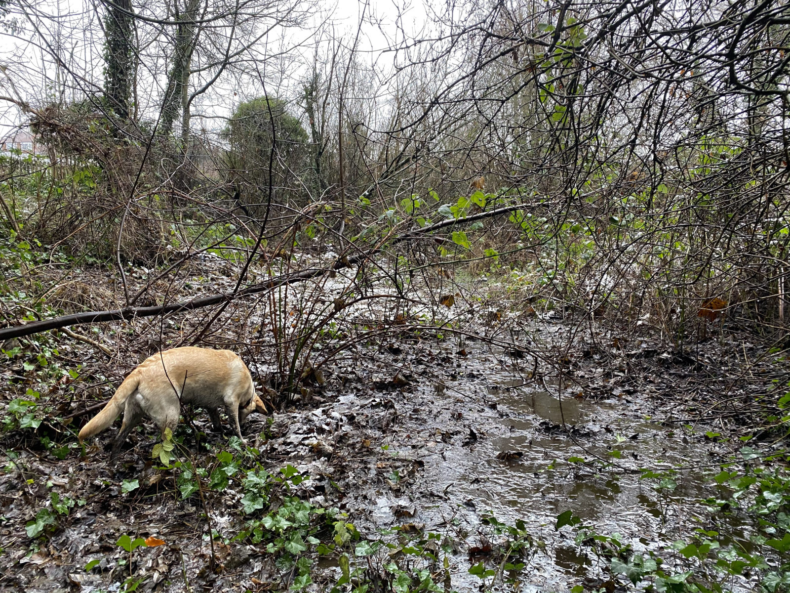
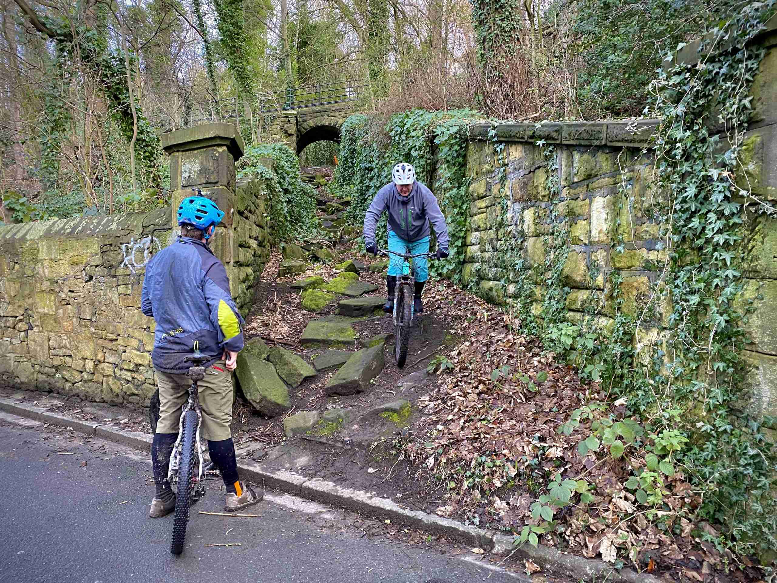
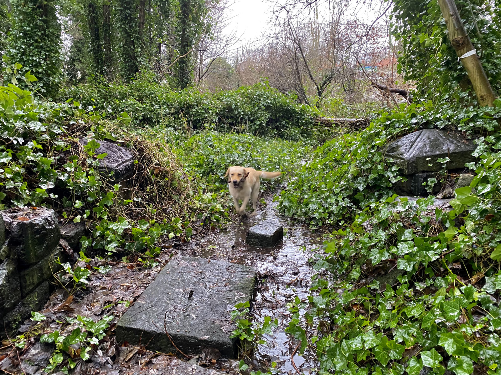
The cutting today known as the cattle run starts on Ouseburn Road, rising and curving to finish unceremoniously in a quagmire forming the southern boundary of the plots administered by the 103-year-old Armstrong Allotments Association. Waterlogged and overgrown, this patch of land is understandably little-visited today. (Wear wellies.)
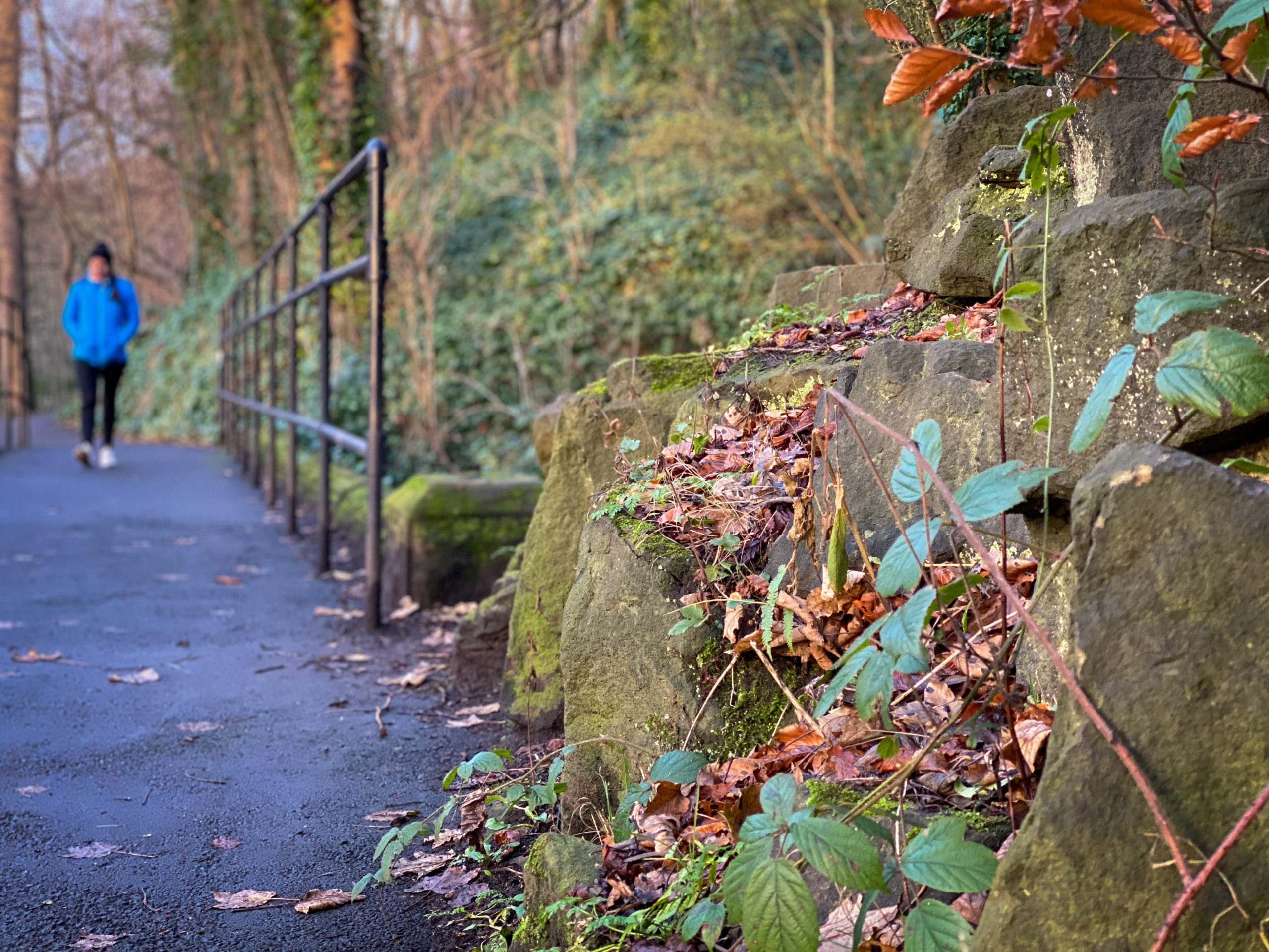
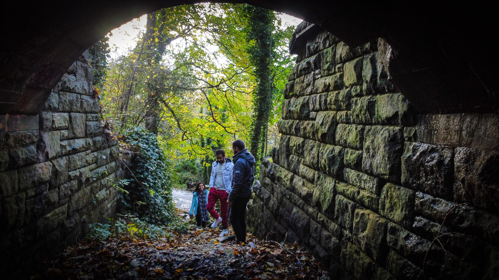
As the interpretation panel rightly points out, the cutting’s high-quality sandstone blockwork is reminiscent of Victorian railway infrastructure. Some of the sandstone blocks and their coping stones have fallen to the ground — or, more likely, were pushed — and they lie scattered on the feature’s floor, an ankle-twisting deterrent to those wishing to walk along the cattle run.
Armstrong Park was known as Bulman’s Wood in 19th Century; the “cattle run” looks like a railway cutting
There are two pillars at the Ouseburn Road entrance of the cattle run, eight courses high and capped with flat coping stones.
If you brush fallen leaves to one side, you’ll uncover rusted remains of iron railings where, within living memory, a gate once closed off the sunken feature at the roadside pillars, one of which is decoratively triangular.
At the opposite end of the cattle run the sandstone blocks fade almost to ground level. This entrance is marked by stumpy, ivy-covered pillars, only one of which is now easily visible. This pillar, only a couple of courses high, is capped with a pyramid-shaped coping stone.
“The quality of the stone work was intended to be seen,” a Manchester-based archaeologist told me, “but not by agricultural labourers and cows,” she added.
Hanna Steyne specialises in 19th Century landscapes. I sent her a great many photographs of the cattle run and surroundings, including drone shots, and she also accessed period mapping to suss the contemporary lay of the land.
“I would not expect decorative column features on a structure only to be used for agricultural purposes,” she pointed out.
On several period Ordnance Survey maps, Armstrong Park’s elongated feature is marked with a finger-shaped 100ft contour line. It’s likely that the masonry of the cattle run shored up what was once a natural feature in Bulman’s Wood, a feature that the Newcastle Daily Chronicle in 1884 called a “deep gully.”
As shown on the map from Armstrong’s 1879 Deed of Gift, this gully contained a linear feature prior to the following year’s construction of the cattle run.
LANDSCAPE ARTIST
Hydraulics innovator and arms manufacturer Lord Armstrong was a noted philanthropist. Five years after handing Bulman’s Wood to the people of Newcastle he gifted the larger Jesmond Dene to the city. This provision of an amenity for his fellow citizens was generous but, back in 1878 when he first discussed the Gift, would he really have commissioned a channel in a deep gully to keep cows away from people in a park he was soon to give away? It’s far more likely that when he charged his agents with designing the cutting, he and they had something else in mind.
By the time the cutting was built in 1880 the land was owned by the Newcastle Corporation. The council had no need for such a feature so it was likely to have been built on Armstrong’s orders, and with his cash, on the undocumented understanding that he had a commercial use for it.
KRAAL RANGERS
According to a Historic Environment Record database entry on the Tyne and Wear section of the usually dependable Sitelines website, the cattle run is a “stone-lined animal kraal which took Armstrong’s cattle from grazing land to the east to the lower pasture land to the west, without disturbing visitors to the park.”
What was the historical source for this citation? “Pers. Comm. Jesmond Dene Rangers, 2004,” says Sitelines.
There’s nothing wrong with using such local knowledge — especially when such “personal communications” were gleaned from folks out there in all weathers looking after our parks and who, in the course of their work, probably hear their fair share of handed-down history — but it’s odd that the entry only cites unnamed 21st Century rangers rather than providing 19th Century sources.
For Lord Armstrong to go to the considerable expense of sinking a bovine passageway, it would, you might think, have to be a feature in regular use and therefore would have been of at least passing interest to the local press. Yet not in any of the long and detailed descriptions of Armstrong Park in contemporary newspapers have I found mentions of a “cattle run,” a “kraal” or any other bovine-related use for the feature.
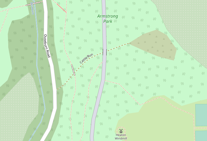
Nor have I found any period maps, not even those of the largest scale, that mark the feature as a “cattle run.” The only maps to do so are modern and crowdsourced such as OpenStreetMap, a volunteer-edited online resource founded, coincidentally, in 2004.
DON’T HAVE A COW, MAN
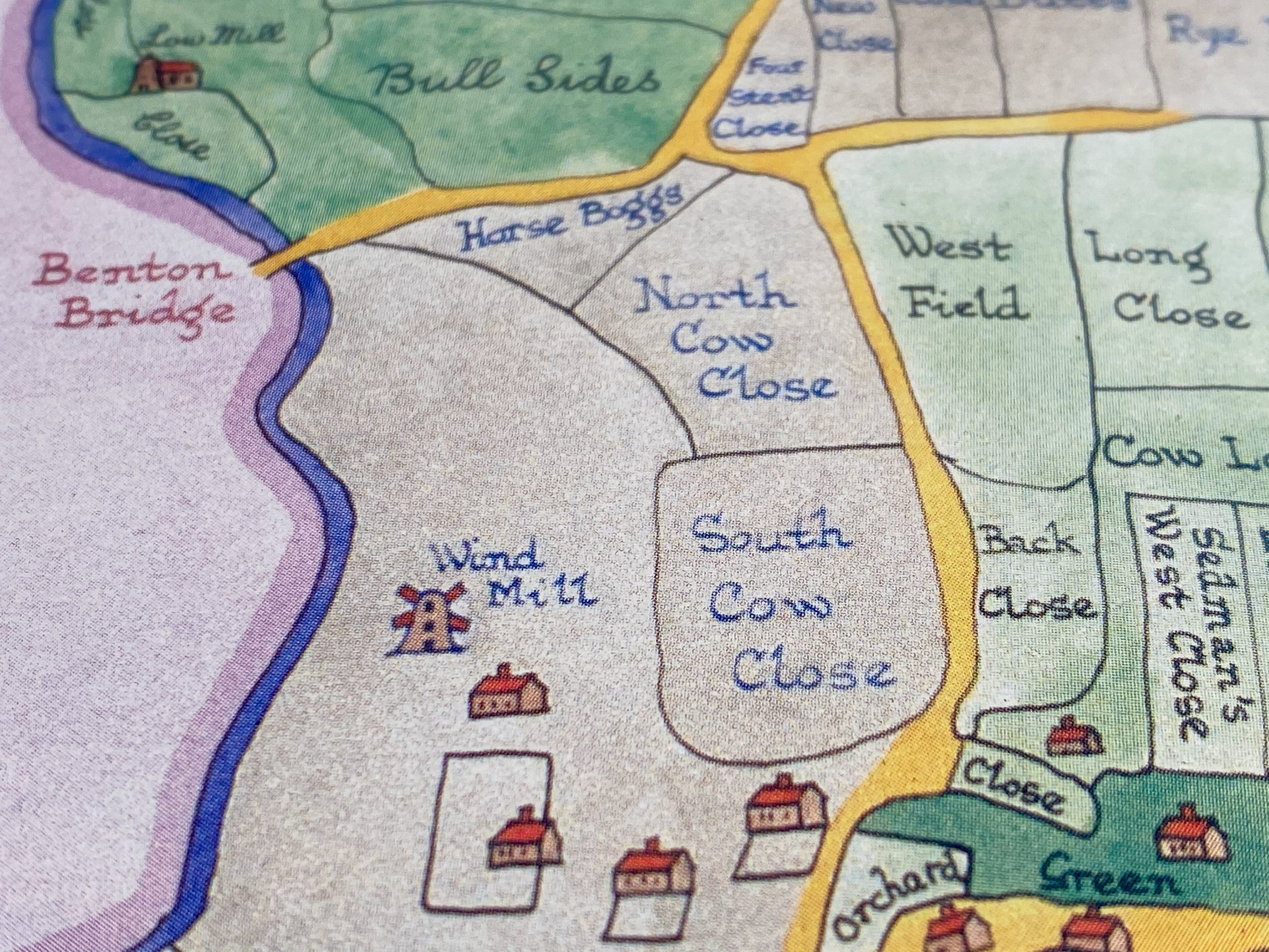
Might there have been a time-out-of-mind cattle track through the deep gully of Bulman’s Wood? Maybe. According to an 18th Century field-name map, there were two large fields adjoining what became Heaton Road: North Cow Close and South Cow Close, both probably belonging to Low Heaton Farm. (The fields are today underneath houses to the west of St. Gabriel’s church and the Armstrong Allotments.)
On the other side of Heaton Road there was a “P”-shaped field called Cow Loan belonging to Heaton Town Farm. (Low Heaton Farm was roughly under the junction between the later Stratford Road and Bolingbroke Street; Heaton Town Farm was off Heaton Road, between today’s Heaton Mosque and Heaton Methodist church on Simonside Terrace.)
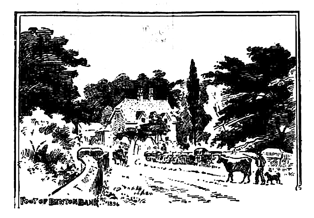
Benton Bridge Farm was a dairy farm according to census records in 1891, 1901 and 1911, and could have been one before 1891, too. (This dairy farm was at the junction where Ouseburn Road joined the Newcastle to Benton turnpike, today’s Coast Road; the farm is now a house called Woodburn, that, in exterior design, is little changed from the 1890s.)
Bingo, you might think, cows. However, the existence of these three field names and at least two dairy farms in the vicinity does not necessarily mean that cows would be taken to pasture on fields beside the Ouseburn.
Might cows have been taken down to the Ouseburn not for pasture but to drink? Thomas Oliver’s 1844 map of Newcastle shows Heaton Road, Heaton Hall’s garden that would become Heaton Park’s bowling green, and Ouseburn Road and, close to where the cattle run would be later built, there’s a field boundary. There’s no path marked at this point, for cows or otherwise, and it’s possible that cows might have been herded along the edge of this field and down to the river.
But as there were several water sources in or near the cow-themed fields was there any real need to lead cattle to a stream? Archaeologist Hanna Steyne thinks not:
“From the topography identifiable from mapping, it seems highly unlikely that cows would be heading for pasture down by the river — there seems to have been plentiful farm land on which to graze cows.”
The three large fields may have corralled cows in the 18th Century but, by the mid-19th Century, only one of them — Cow Loan — was still being used for that purpose, and this only fractionally. According to an 1868 document mapping Armstrong-owned land in Heaton, only about an eighth of the fields worked by Heaton Town Farm and East Heaton Farm were devoted to pasture. (Today, these fields are mostly underneath Ravenswood Primary School and the Northumberland Hussar on Sackville Road.)
Heaton Town Farm was an arable and dairy farm, owned through the 18th and most of the 19th Centuries by the aristocratic Ridley family, the leading members of which, until 1826, had resided at Heaton Hall before their seat was removed to Blagdon in Northumberland.
Sir Matthew White Ridley, the fourth Baronet, was the farmer of the family. He had a “thorough liking for agricultural pursuits, and took a deep interest in all matters relating to the farm,” reported an 1877 obituary.
“As a breeder of cattle,” continued the obituary, “he was known throughout the whole of the North of England.”
Ridley “bred prize cattle on a large scale,” confirms another report, although this was at the family estate at Blagdon and several model farms elsewhere in Northumberland rather than at the family’s leased farms in Heaton.
Ridley sold Heaton Town Farm’s land and buildings in 1865. All were either then or soon after that owned by Sir William Armstrong. From the 1840s to the 1860s, the farm was leased by the 4th Baron Ridley to George Cairns. In the 1861 census, Cairns (who also features in records as “Carins”) was listed as working 145 acres of mixed farmland, employing “4 men, a boy and women labourers.” Cairns lived with a housekeeper, a ploughman, a 19-year-old Irish dairymaid and a 14-year-old “cow keeper.”
In the 1880s, the farm — made up of several separate houses — was worked by widower Edward Edgar, described in the 1881 census as a contractor and dairy farmer of now just 27 acres. Also living in one of the farm’s houses was David Kennedy, described as a dairyman and who likely worked for Edgar.
Clearly, there were cows in this part of Heaton when Armstrong or his agents commissioned the feature which became known as the cattle run, but by the 1870s there would have been just a small number of them rather than herds so large and potentially disruptive that they required a cow cutting.
In the 19th Century, “dairy farming was seen as a fairly abhorrent activity,” said Steyne, “and one which should be hidden from the delicate middle classes.”
Armstrong, who was elevated to the peerage as Lord Armstrong in 1887, owned several Newcastle farms, at least two of which had cows on them. He kept small herds at Castles Farm (near to today’s David Lloyd fitness club) and at Benton Place (underneath today’s HM Revenues and Customs building off Benton Road).
However, it’s unlikely these herds would have ventured as far as Bulman’s Wood, so we’re left with the small number of cows at Heaton Town Farm and Benton Bridge Farm. By 1916, Benton Bridge Farm housed just three cows, said to be “shockingly emaciated.”
“The idea that cattle would be walked through a formal Victorian park is fairly strange,” suggests Steyne.
“The whole point about Victorian parks was that they were controlled ‘natural’ environments — nature made beautiful — but deliberately separated from the reality of the [actual] natural environment.”